Greenhouse gas emissions from the way humans produce and consume food could add nearly 1 degree of warming to the Earth’s climate by 2100, according to a new study.
Continuing the dietary patterns of today will push the planet past the 1.5 degrees Celsius (2.7 degrees Fahrenheit) limit of warming sought under the Paris climate agreement to avoid the worst effects of climate change, according to the study published Monday in Nature Climate Change, and will approach the agreement’s limit of 2 degrees Celsius (3.6 degrees Fahrenheit).
The modeling study found that the majority of greenhouse gas emissions come from three major sources: meat from animals like cows, sheep and goats; dairy; and rice. Those three sources account for at least 19% each of food’s contribution to a warming planet, according to the study, with meat contributing the most, at 33%.
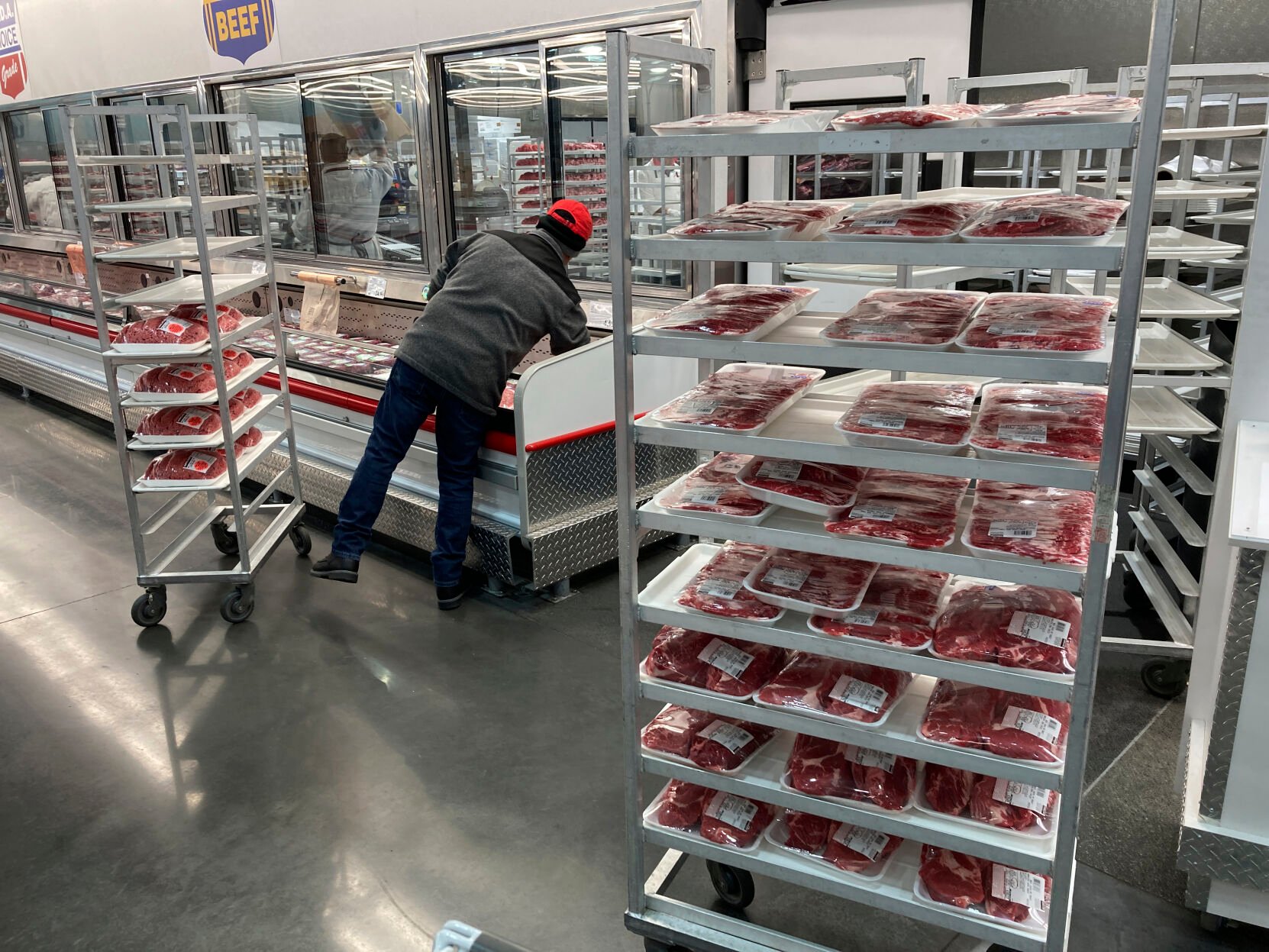
Wilfredo Lee
FILE - An employee restocks meats on Jan. 17, 2023, in North Miami, Fla. Greenhouse gas emissions from the way humans consume food could add nearly one degree of warming to the Earth’s climate by 2100, according to a new study Monday, March 6, 2023. Researchers found that the majority of greenhouse gas emissions come from three major food groups — meat from animals like cows, sheep and goats, dairy and rice. (AP Photo/Wilfredo Lee, File)
All emit large amounts of methane, a potent greenhouse gas with more than 80 times the warming power of carbon dioxide, in the way they are currently farmed. The researchers calculated that methane will account for 75% of food’s share of warming by 2030, with carbon dioxide and nitrous oxide accounting for most of the rest.
“I think the biggest takeaway that I would want (policymakers) to have is the fact that methane emissions are really dominating the future warming associated with the food sector,” said Catherine C. Ivanovich, a climate scientist at Columbia University and the study’s lead author.
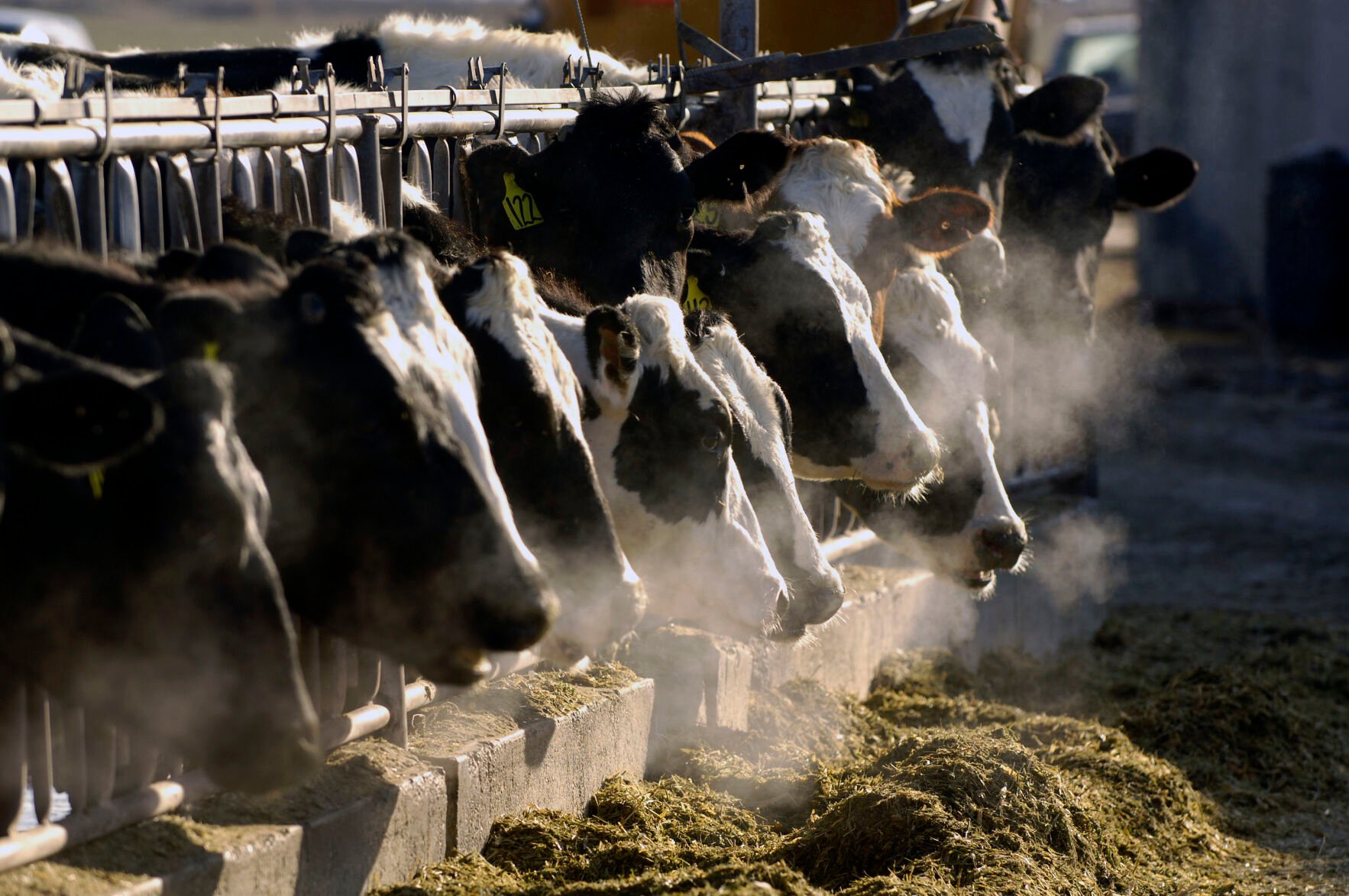
Charlie Litchfield
FILE- A line of Holstein dairy cows feed through a fence at a dairy farm on March 11, 2009, outside Jerome, Idaho. Greenhouse gas emissions from the way humans consume food could add nearly one degree of warming to the Earth’s climate by 2100, according to a new study Monday, March 6, 2023. Researchers found that the majority of greenhouse gas emissions come from three major food groups — meat from animals like cows, sheep and goats, dairy and rice. (AP Photo/Charlie Litchfield, File)
Ivanovich and colleagues from the University of Florida and Environmental Defense Fund calculated the three major gases produced by each type of food over its lifetime based on current consumption patterns. Then they scaled the annual emissions over time by gas based on five different population projections.
And then they used a climate model frequently used by the United Nations’ panel on climate change to model the effects of those emissions on surface air temperature change.
Stanford University climate scientist Chris Field, who wasn’t involved in the study, said it used well-established methods and datasets “to produce a novel, sobering conclusion.”

Alberto Pezzali
FILE - People sit, drinking and eating, outside cafes and pubs Soho, central London, April 12, 2021. Greenhouse gas emissions from the way humans consume food could add nearly one degree of warming to the Earth’s climate by 2100, according to a new study Monday, March 6, 2023. Researchers found that the majority of greenhouse gas emissions come from three major food groups — meat from animals like cows, sheep and goats, dairy and rice. (AP Photo/Alberto Pezzali, File)
“The study highlights that food is absolutely critical to hitting our Paris Agreement climate targets — failure to consider food is failure to meet our climate targets globally,” said Meredith Niles, a food systems scientist at the University of Vermont who was not involved in the study.
The study offered some ways to change global food production and consumption that could limit warming.
Many of these changes are already being called for or adopted. U.S. President Joe Biden touted the climate benefits of planting cover crops that can draw down carbon from the atmosphere in an April 2021 address to Congress. Multiple recent studies and reports have recommended eating less meat in order to reduce greenhouse gas creation by animals raised for consumption. And California started a mandatory food waste recycling program in 2021 to reduce the emissions created by decaying food.
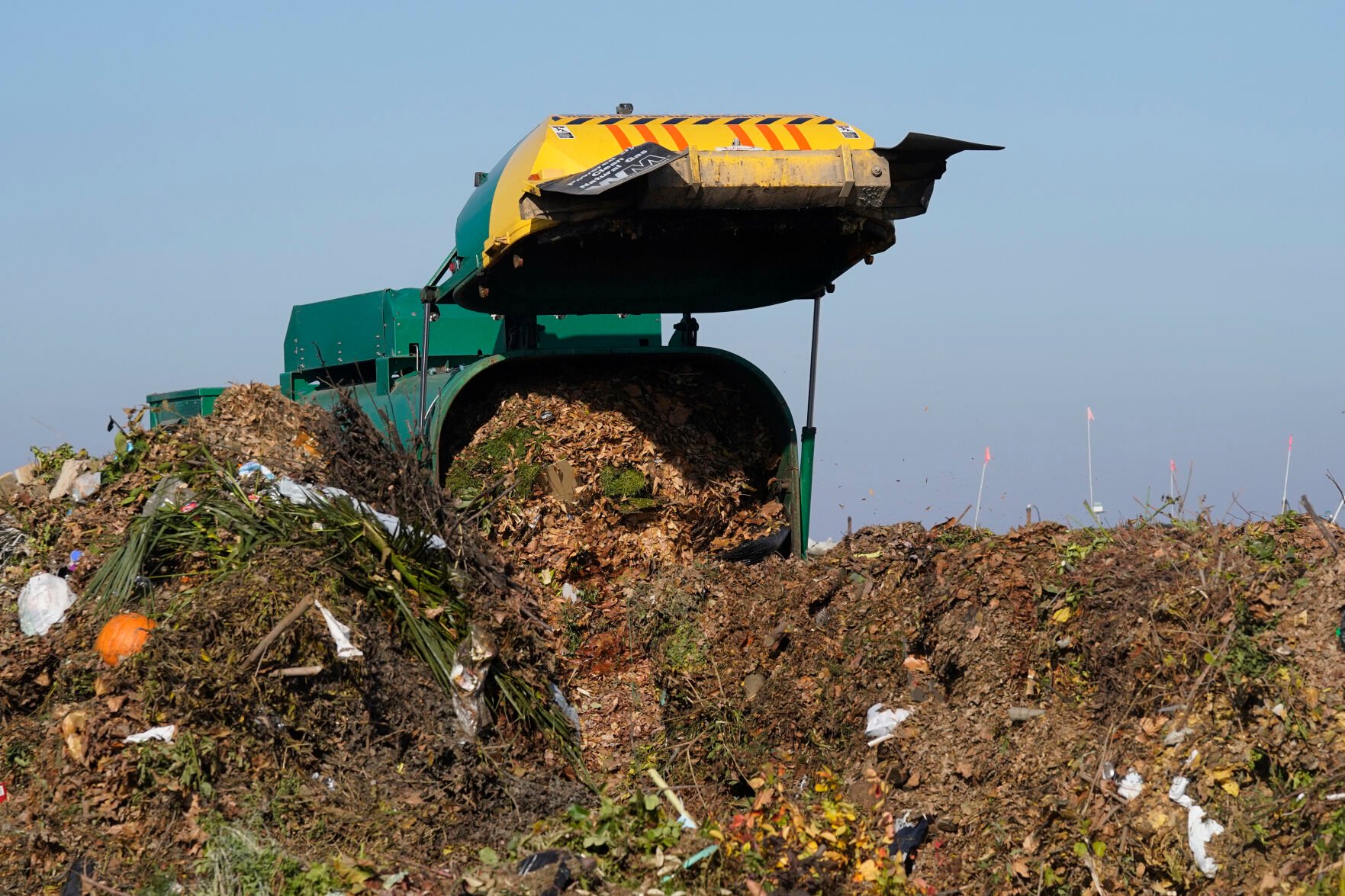
Rich Pedroncelli
FILE - A truck unloads organic waste to be used for composting at the Anaerobic Composter Facility in Woodland, Calif., on Nov. 30, 2021. Greenhouse gas emissions from the way humans consume food could add nearly one degree of warming to the Earth’s climate by 2100, according to a new study Monday, March 6, 2023. California started a mandatory food waste recycling program in 2021 to reduce the emissions created by decaying food. (AP Photo/Rich Pedroncelli, File)
But reducing methane may be the most important goal of all. Although methane is far more potent than carbon, it also is much shorter-lived — meaning cuts in methane emissions can have a quick benefit, Ivanovich siad.
“So that’s going to help us stay under the dangerous warming target,” she said, “as well as give us some time to build up resilience and adaptation to climate change in the meantime.”
A major question that remains is whether food producers and consumers can change their behavior in order to achieve the reductions in greenhouse gases laid out in the study. There’s a roadmap, but will it be followed?
“Changing behavior, especially when we are bombarded with constant media extolling the benefits of everything from Coke to french fries, from pizza to burgers, is pretty damned difficult,” Columbia University plant physiologist Lew Ziska in an email to the AP. “So, overall, while we need to change, whether we can change is …. problematic.”
___
-
Ladakh herders endeavor to save future amid climate crisis
Ryan DeBerardinis // Shutterstock
Urban heat islands are areas within cities that are hotter than their outlying regions, largely due to albedo—the tendency of a material like asphalt or pavement to absorb, rather than reflect, heat from the sun. Lack of tree cover, an abundance of tall buildings, and population density can amplify this phenomenon as well.
These hot spots generally experience temperatures about 1-7 degrees Fahrenheit higher during the day and 2-5 degrees Fahrenheit higher at night than the surrounding areas. The rise in temperature increases the chances of air pollution and could prove dangerous for those without air conditioning. Urban heat retention isn't just uncomfortable: it's a serious public health threat.
More than 80% of Americans live in urban areas, according to Census data. But within these areas, it is almost always those in low-income and underserved neighborhoods that find themselves living in urban heat islands. This makes them not only economically disadvantaged, but also more at risk of the slew of health dangers urban heat islands pose.
Many of the most heat-intense cities in the U.S. are older cities in the Northeast. These are more compact and developed than other parts of the country. They also tend to have taller buildings, which adds to the heat island effect.
New Jersey Real Estate Network examined data from climate change nonprofit Climate Central to find which cities experience the most intense heat due to overbuilding, also known as the urban heat island effect. Out of 159 assessed cities, these 10 had the highest index.
-
Ladakh herders endeavor to save future amid climate crisis
ESB Professional // Shutterstock
- Index score: 7.08
- Main contributors: Building height, impermeable surface
Providence owes its high heat concentration in part to a large highway (Route 95) that cuts through the city, and its frequently used industrial port. Areas like Pavilion Avenue, which are sparsely covered in tree canopy, are particularly heavily affected.
This means that lower-income and minority members of Providence's population bear the brunt of the urban heat island effects as is true in almost every other city. For instance, childhood asthma rates are highest in the parts of the city where heat island intensity is also highest. To combat this, the Providence Neighborhood Planting Program is offering citizens the opportunity to have free trees and greenery planted in their areas.
-
-
Ladakh herders endeavor to save future amid climate crisis
Sean Pavone // Shutterstock
- Index score: 7.08
- Main contributors: Building height, impermeable surface
The worst of Baltimore's urban heat island is in the east of the city, especially the neighborhood of Patterson Park. In these areas, temperatures are as much as 20 degrees higher than elsewhere in the city, with heat-hoarding roofs and roads largely to blame.
To lower temperatures, the city is hoping to implement "cool roofs," which would have collateral benefits for the local economy, flood damage prevention, and public health. The B'More Cool initiative, started in 2014, is investigating where Baltimore's urban heat islands are the worst and how to best mitigate the damage. Among their sustainable solutions is an unexpected tactic the entire community can help with: composting.
-
Ladakh herders endeavor to save future amid climate crisis
Mia2you // Shutterstock
- Index score: 7.24
- Main contributors: Building height, impermeable surface
Miami broke new ground in addressing urban heat islands when it inaugurated the world's first chief heat officer. Since taking the role, Jane Gilbert is devising solutions to dissipate the strength of urban heat islands, and the class inequities in health they dole out. Among these are climate resilience hubs, which will offer relief for residents suffering through a heat spell.
Additionally, Keep Safe Florida is stepping in to assist low-income residents in these hot pockets of the city. The program provides funding for low-income properties to install and update infrastructure to protect against urban heat islands, as well as other effects of climate change.
-
-
Ladakh herders endeavor to save future amid climate crisis
ezellhphotography // Shutterstock
- Index score: 7.24
- Main contributors: Building height, impermeable surface, population density
Chicago's heat concentration is quite skewed, thanks to the city's position on Lake Michigan. With the lake's waters cooling downtown, it is the city's western suburbs that are heating up disproportionately. The fact that these areas are also increasingly developing, with additional heat-absorbing buildings and structures being constructed, only adds to the intensification.
To fight against this, Chicago's city government has developed a series of building codes and green infrastructure projects. These include plans to install reflective roofing and rooftop gardens; requiring that newly built flat roofs meet EPA standards; and offering funding for projects that will encourage greenery and other heat island mitigation.
-
Ladakh herders endeavor to save future amid climate crisis
Marcio Jose Bastos Silva // Shutterstock
- Index score: 7.24
- Main contributors: Building height, population density
Boston's neighborhoods with high concentrations of pavement, asphalt, dark roofs, and high buildings are where urban heat islands can be found. These include the neighborhoods of Chinatown, Dorchester, East Boston, Roxbury, and Mattapan.
The city's Heat Resilience Solutions for Boston is a plan designed to counteract these heat-gulping hot spots, especially during the summer. Strategies laid out include a grant program to fund the installation of cool roofs, as well as plans to distribute cooling kits to the public during outdoor summer gatherings. The Extreme Temperatures Response Task Force has been directed to design action plans to put these ideas into motion.
-
-
Ladakh herders endeavor to save future amid climate crisis
Daily Travel Photos // Shutterstock
- Index score: 7.37
- Main contributors: Building height, impermeable surface, population density
San Francisco's environmentally friendly reputation makes it a receptive city to try solutions for urban heat islands. The Next Generation Urban Greening Project hopes to expand preexisting sustainability programs from the city's affluent neighborhoods to its poorer ones, where urban heat islands are concentrated. Plans are being considered to redesign sidewalks and buildings to accommodate greenery and reflective materials, even if strategies must be fitted uniquely block by block.
In January 2017, San Francisco became the first city in the U.S. to require at least 15-30% of roof space to have solar panels or greenery. The city's Clean Air Plan also suggests implementing a "cool parking ordinance," which would pay particular attention to planting and installing shade materials in parking lots, which are major culprits for absorbing heat.
-
Ladakh herders endeavor to save future amid climate crisis
Nate Hovee // Shutterstock
- Index score: 7.46
- Main contributors: Impermeable surface, surface color/reflectivity
The Houston Harris Heat Action Team, or H3AT, attempted to map the city's urban heat islands in 2020 and found that areas close to Richmond Avenue and Chimney Rock Road were noticeably hotter than others. Many of Houston's hot spots are not random, but the result of past patterns of socioeconomic inequality.
The city's Third Ward neighborhood has found itself an urban heat island largely because of historical bureaucracy and systemic decision-making that sidelined the community from programs to develop parks and green spaces. Overall, only 18% of the city is shaded. The city would need to plant 2.4 million trees to provide adequate shade for all residents.
-
-
Ladakh herders endeavor to save future amid climate crisis
Andriy Blokhin // Shutterstock
- Index score: 7.62
- Main contributors: Building height, impermeable surface, population density
It is perhaps not surprising that the "concrete jungle" is also the third-worst urban heat island in the country. There are over 6,000 high rises and more than 270 skyscrapers in New York City, all of which suck in the sun's rays and heat up the city. The NYC CoolRoofs project paints urban rooftops around the city white, which lessens the extent to which they absorb heat. The initiative focuses on providing this service to nonprofits, low-income residential areas, community centers, and schools.
Cool Neighborhoods NYC, established in 2017, has dedicated $106 million to reverse the city's heat-hungry infrastructure—$82 million alone will be used to plant trees in the Bronx, Manhattan, and Brooklyn. New York's one saving grace is Central Park, which cools the areas around it. However, as the park's surrounding neighborhoods are some of the wealthiest in the city, low-income residents are once again disproportionately affected by urban heat.
-
Ladakh herders endeavor to save future amid climate crisis
quiggyt4 // Shutterstock
- Index score: 7.71
- Main contributors: Impermeable surface, building height, population density
Newark's Ironbound neighborhood suffers significantly from heat hoarding, in part because of its population density: It is home to around 50,000 people within 4 square miles. It doesn't help that the neighborhood is also slated for construction projects that will increase its tall, heat-absorbing structures, including a six-story apartment building, a 13-story retail space, and an 11-story building near Penn Station.
To understand why Newark's urban heat islands exist where they do, one can look as far back as the 1930s and 1940s, when funding was allocated to other neighborhoods of the city. This led to many Newark residents—including a disproportionate number from lower income and minority neighborhoods—lacking heat-deflecting green spaces while other areas in the wealthier North Ward received more investment, more trees—and decades later, less heat.
-
-
Ladakh herders endeavor to save future amid climate crisis
Sean Pavone // Shutterstock
- Index score: 8.94
- Main contributors: Surface color/reflectivity, impermeable surface
New Orleans' lack of tall buildings may offer an aesthetic benefit, but it leaves the city with a climate disadvantage, lacking much shade from the sun. The city also has a high number of dark roofs and roads, in combination with a low amount of greenery. Hurricane Ida worsened the city's ability to fight against intense heat, cutting residents off from power, and with it the ability to use fans or air conditioners.
The city government has pledged to reverse this and reach 30-40% of the city covered in green areas by 2030. Supplementing this, Sustaining Our Urban Landscape has planted 5,000 trees in the last five years alone, attempting to compensate for the 100,000 trees lost during Hurricane Katrina.
This story originally appeared on New Jersey Real Estate Network and was produced and distributed in partnership with Stacker Studio.
-
One-third of food produced in the US goes to waste. Here’s how that impacts the environment
Polarpx // Shutterstock
There are 900 million acres of farmland in the United States, broken into more than 2 million farms. This accounts for approximately 40% of all acreage in the U.S.
Much of this farmland is used to raise livestock and grow corn and soybeans. But not all of it is used to produce foodstuffs for direct human consumption—a lot of it is used to produce food for livestock. This makes livestock and other animal production farms and facilities ancillary beneficiaries of U.S. farming. Agriculture, food production, and related industries (such as food manufacturing and retailing) were responsible for $1.055 trillion of the United States' gross domestic product in 2020—5% of the overall GDP.
To look at the environmental impact of domestic food waste, OhmConnect cited data from the EPA publication From Farm to Kitchen: The Environmental Impacts of U.S. Food Waste, released in November 2021.
One-third of all food produced annually is unconsumed and simply becomes waste. This also means that the resources used to produce that food in the supply chain—water, pesticides, gas or diesel used for freight and delivery, and energy for refrigeration—are also wasted.
The U.S. Environmental Protection Agency concluded that the U.S. wastes between 161 and 335 billion pounds of food per year, equal to anywhere from 492 to 1,032 pounds per person annually. To translate this figure into something most people are aware of and many actively keep track of, this equates to as much as 1,520 calories per person per day wasted, or enough food to feed 150 million people.
Food loss and waste per person increased over the last decade and tripled since 1960. Fruits and vegetables are among the foods that go to waste most often, and the consumption stage—typically at home or in restaurants—is responsible for approximately half of that waste.
-
-
One-third of food produced in the US goes to waste. Here’s how that impacts the environment
OhmConnect
Every type of food is wasted most during the consumption stage, which occurs in homes, restaurants, and other food service establishments. A 2020 study projecting the environmental benefits of cutting the U.S.'s food loss and waste in half found that addressing households, restaurants, and food processing would have the biggest effect on the environment, whereas addressing institutional food service or retail would have a minimal environmental impact.
According to Brian Roe, professor and faculty lead at the Ohio State Food Waste Collaborative, the average American family can put thousands of dollars of food in the trash each year.
An American Journal of Agricultural Economics study published in 2020 found the loss to be $240 billion in total in homes nationally, breaking down to $1,866 per household—though based on the most current U.S. Census' findings of the total number of U.S. households, that figure is closer to $1,961 per household.
-
One-third of food produced in the US goes to waste. Here’s how that impacts the environment
Aleksandr Rybalko // Shutterstock
- Agricultural land wasted: 19,000 square feet
- Water: 19,000 gallons
- Pesticides: 2.5 pounds
- Fertilizer: 44.5 pounds
- Energy: 2,140 kilowatt-hours
- Greenhouse gas emissions: 1,190 pounds CO2
The issue with food loss and waste isn't just about what ends up in the trash can. It's about the loss and waste of everything that went into that potato, or banana, or onion—the water, the land, the pesticides, the fertilizer, and the energy add up to a greater, compounded loss.
To determine the environmental impact of food loss and waste, researchers consider how much food is lost or wasted, the type of food it is, and where in the supply chain it was wasted. The further along the supply chain food is wasted, the greater the impact on the environment because impacts are cumulative.
All told, the greenhouse gas emissions from one person's wasted food annually are equivalent to those from the average passenger car driving 1,336 miles. And the estimated water wasted is roughly what an average American household uses over the course of 63 days.
-
-
One-third of food produced in the US goes to waste. Here’s how that impacts the environment
vchal // Shutterstock
Ninety percent of food wasted in the supply chain is edible, with inedible things like bones and shells making up the other 10%. Studies put the number of wasted calories per day between 1,100 and 1,520, a sizable portion of the recommended daily caloric intake.
This waste ends up in a landfill. According to the EPA, food waste is the nation's most commonly found material burned at landfills—it accounts for 24% and 22% of landfilled and combusted municipal solid waste, respectively.
-
One-third of food produced in the US goes to waste. Here’s how that impacts the environment
OhmConnect
North Americans waste more than three times what people waste in the Middle East, North Africa, Latin America, and the Caribbean, and more than 10 times what people in South Asia and sub-Saharan Africa waste.
When looking at food waste and loss by regional wealth, people in the U.S. waste 503 grams per person per day—196 grams more than those in other high-income countries. Food loss decreases as regional wealth decreases: People in low-income countries waste just 43 grams per person per day.
Country by country, the U.S. is surpassed by only two in the generation of food waste (China and India) and two in food waste per person (New Zealand and Ireland).
-
-
One-third of food produced in the US goes to waste. Here’s how that impacts the environment
OhmConnect
Fruits and vegetables make up 80% of all food loss and waste in sub-Saharan Africa and 64% of all food loss and waste in industrialized Asia. In North America and Oceania, they make up about half of all wasted food. According to the Food and Agriculture Organization, up to 60% of all fruits and vegetables find their way into landfills.
Some of the food waste is attributed to the financial, technical, and managerial constraints of producing food in countries with a less developed infrastructure, as well as underdeveloped food distribution networks and poor harvest and handling technology and techniques. These together result in billions of dollars in losses yearly. Much of the waste is also attributable to the demand for "perfect" fruits and vegetables.
Cutting the nation's food loss and waste in half could meaningfully conserve resources and reduce the environmental impacts of the food system, according to the EPA. By halving the food loss and waste across the country, the U.S. could lessen the environmental footprint by 3.2 trillion gallons of water as well as 262 billion kWh of energy—that's enough to power 21.5 million U.S. homes for a year.
This story originally appeared on OhmConnect and was produced and distributed in partnership with Stacker Studio.
